-----
Since I first arrived in Columbus, I've wanted to
take advantage of the 15 metro parks around town.
But it wasn't until Labor Day--with no other plans--
that I embarked on my first adventure.
-----
As with any anal retentive person, the question to
where I should begin was easy: at the beginning
of the alphabet, silly!
-----
I'm certain the Battelle company helped
fund this project, but the other part of the
name is derived from a couple of waterways
that are part of the park itself: the Big Darby
and Little Darby creeks.
-----
According to the signage below,
a valley was created when the glaciers began
to melt away at the end of the last Ice Age.
-----
For those of you not familiar with Ohio topograpy,
below is a glacial map of the state. Although this
is a sweeping statement, anything white on this map
was not impacted by a glacier. As a result, some of
the state's most beautiful scenery lies in the
southeastern part of the state. (If a glacier sat on
top of you for gazillions of years, you'd be flat, too!
The white portions represent the hilly regions
of the Buckeye State. But as a Southerner, I
know what comes with more rugged terrain
and beauty: you become the stupid country
people to the rest of civilization.)
-----

-----
I'm sure someone is dying to know what
the blue color is in the extreme northwestern
part of the state so I'll tell you.
When the glacier finally finished melting,
this area was so low that it was once part
of Lake Erie! Nowadays, it's as flat--and
fertile--as the Mississippi Delta.
Toledo is in this section of the state.
(There are no major cities in the
hilly portions of Ohio.)
-----
So above and below are shots
of the Big Darby Valley.
-----
From the lookout, I took the first path
to the creek--Cobshell Trail.
-----
-----
Battelle-Darby is the largest
of Columbus' 15 metro parks.
-----
-----
Forty-one species of mussels
live in the creek's sparkling waters.
It's like the the people below
are trying to identify a few species.
-----
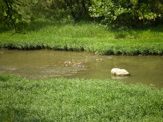
I hope the photo shows the beauty
I was trying to capture. The creek is
not muddy. What is seen below is the
creekbed below the transparent water.
-----
 -----
-----Single click on the photo below
to read more about the this creek.
(If you are able to read this sign,
please note that the Olentangy
River that flows through Columbus
proper is not the Ollentangy that
became Darby. Same name,
different waterway...)
-----
 -----
-----The only reason I enlarged
this map was to show my friends
back home home much of Franklin
County Columbus consumes.
(The park I'm visiting is on the
extreme southwestern side of the
county which is shown in green below.)
-----


 -----
-----I have to admit that the photo below
is one of my favorites from the bunch.
-----
 -----
-----This is where the trip got eerie for
a little while. The creek stops.
Just stops.
-----
 ----
----The rocks are dry.
-----
 -----
-----And then, all of a sudden,
it starts back up.
Is it flowing underground?
-----
 -----
-----In the shot above, notice the land to
the right of the photo. That's not
the creek bank: it's one side of an island.
-----
 -----
-----The park boasts forests, fields
and meadows, and prairies.
I did not partake of any of the
prairies during this five-mile hike.
----
 -----
-----In the above photo, if you click on it,
you'll notice an old cemetery at the top
of the hill. Very picturesque!
-----
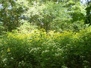
I was told the plant species below
might be ironweed.
I do know my mother and her
mother would love the flowers
here: Mama's favorite color is
purple (about this shade, in fact),
and MawMaw's was pale pink.
-----
 -----
-----The shot below is a vehicular bridge
that crosses the Big Darby and that also
intersects into Alkire Road within
twenty steps of the overpass.
-----
 -----
-----To my great delight, it was time for
the Little Darby Creek to join
the larger Big Darby.
----
 -----
-----Yeah, it was more sweet than
spectacular, but I liked it all the same.
-----
 -----
-----The Village of Georgesville moved to
the other side of the rivers when the
railroad came through town.
understand progress, but I HATE
that a concrete bridge support
sits at the confluence of these
two bodies of waters. How
unromantic is that!
-----
 -----
-----However, I couldn't have staged a
better nature shot!!!
-----
 -----
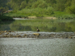
-----This Canadian goose is perched atop
a rock at the very mouth of the
Little Darby, as if keeping watch.
-----
 -----
-----More photos of the merging of waters
after a few floral shots...
-----


The shot above is a little farther
downstream. Still, Mr. or Mrs. Goose
has not moved from his/her spot!
-----
Running parallel to Alkire Road
is the Camp Chase Railroad.
----

Can you see how much lower the bridge
was at one time?
There's another photo below of
just a closeup of the stone work.
-----
Daddy would have appreciated my not
bothering these two serious anglers.
-----


Take a look at the dainty leaves of
the tree below. I know a good deal
about Northeast Mississippi trees,
but I have yet to learn Ohio's
trees' appearances. I think
this might be a locust of some kind.
-----
Now take a look at its bark!!!
-----

Yeah, the little leaves say, "I'm helpless,"
but the trunk says, "Go ahead: make my day."
-----

-----
The photo below is now my computer's
background shot. If you ever see a photo
you'd like to have as your background,
simply single left click on the photo,
then right click on top of the image,
and select "Set as Background."
-----
I found this lovely black cat as I began
my journey down the Ancient Trail loop.
-----

S/he slinked off into the bushes
when I got closer than s/he liked.
-----
This is hardest shot I made.
The tiny butterfly was so full of
energy that I thought it would
never settle. Once it did, I had
to take into consideration my
shutter speed with the constant
flapping of its wings.
-----
I found the one of these flowers
that didn't have honeybees or
bumblebees on it.
(I also saw a hornet on the ground
underneath the bridge where the
two rivers joined paths. Shudder!)
-----
I was so intrigued by the fact that there
was this HUGE Indian mound off the
trail at the metro park!
-----
Uh, yeah...so much for big...
And it wasn't off the trail:
the trail went right over the corner of it!
-----
I have to admit that I'm used to much grander
mounds like the ones about 15 miles from
my hometown in Mississippi:
-----
I'm not sure what this little creature is.
I think it's a mole.
There were two about ten feet apart from
each other in the center of the trail...dead...
-----

Can you see the mound from the other
side of the circular trail in the photo below?
-----
This is the color of pink my grandmother
loved most--a faint, almost white pink.
-----
MawMaw passed away 15 years ago
September 7, 1993.
-----
This was an easy plant to miss,
but I'm glad I saw it!
It looks like the blooms are already
fallen, but I think the petals may
actually be the light green portion
of the flower!!!
-----

My journey of new experiences
came to a close with a familar face.
-----
Unlike above where I zoomed the lens
for closer shots, I am actually getting
closer to the cat in these photos.
-----
My fear was that, as a feral cat, s/he
might be a little temperamental.
Plus, I didn't know how sanitary
the little thing was, and I didn't want
to bring back any parasites to Maria.
-----
Still, it was a nice way to end this trip...
-----


No comments:
Post a Comment